Fieldwork


Location: 5WC7+V8 Mansfield, UK
Season: November 12, 2025 to November 14, 2025
Session Dates: 12th - 14th November, 2025.
Application Deadline: November 11, 2025
Deadline Type: Contact for Details
Website: https://mercian-as.co.uk/gis.html
Program Type:
Field School
RPA Certified:
No
Affiliation:
Mercian Archaeological Services CIC
Project Director:
Andy Gaunt
Project Description:
This 3 day training school is designed to provide delegates with and introduction to using GIS (Geographic Information Systems) for archaeology.
Archaeological GIS training:
Delegates will work with survey data and learn how to create maps, vector layers and geo-reference raster images, as well as create and work with 3D models.
A Geographic Information System (GIS) is a system designed to capture, store, manipulate, analyse, manage, and present spatial or geographic data.
Archaeologists use GIS for many things including creating maps, analysing landscapes, understanding archaeological sites, creating 3D models, viewshed analysis, presenting survey data and more.
GIS is a great way to integrate data from projects and can be used to analyse that data as well as present it in the form of maps for publication.
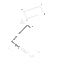
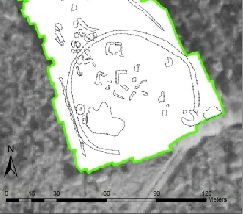
The images to the below include GIS being used in building analysis, surveying, map work, and the displaying of geophysical survey data.
Period(s) of Occupation: All periods
Project Size: 1-24 participants
Minimum Length of Stay for Volunteers: 2 days
Minimum Age: 15
Experience Required: No Experience Required
Room and Board Arrangements:
Accommodation not provided
Andy Gaunt
Staffordshire House Beechdale Road
Nottingham
Nottinghamshire
NG8 3FH
United Kingdom
The AIA is North America's largest and oldest nonprofit organization dedicated to archaeology. The Institute advances awareness, education, fieldwork, preservation, publication, and research of archaeological sites and cultural heritage throughout the world. Your contribution makes a difference.